Gorakhgad and Macchindragad, two forts named after a disciple and his guru (both saints) respectively, lie in the extended Bhimashankar range of the Sahyadris, within the Murbad Taluka of Thane District.
These forts were of strategic importance during the reign of Shahaji Raje (father of Shivaji Maharaj), and later during Shivaji's reign were actually used as a stopover point / activity tracking place during journeys to Junnar via Naneghat.
We travelled to Kalyan on the Central Railway Suburban network , and then by local public road transport. The base village is a place called Dehri. There is a Gorakshnath temple on the Murbad Dehri route , which is the starting point of the trek.
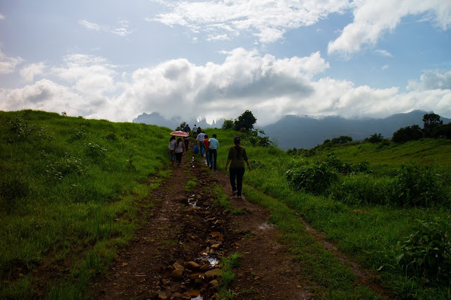
You can see the two peaks , and strangely, the bigger one, is Gorakhgad, while the one named after the guru, Macchindragad, is the smaller peak .
Gorakhgad , at an elevation of 2125 feet, is approached by a path that starts just behind the Gorakshnath temple. The path winds around through an extremely dense jungle , and one is advised to come here only with those who have trekked here before, else it is easy to get lost.
We trekked through an extremely dense jungle, with narrow paths, sort of mildly uphill till we reached on a clearing. After this, the gradient got steeper, the monsoon vegetation, and the sudden rain, also made climbing a bit messy and difficult. The thick jungle blocked most of the natural light. About 20 minutes of steep trekking and we came to a plateau of sorts.
We could see at times, the caves of Gorakhgad, and also saw a Vana Vibhag banner announcing features of the Fort.
The jungle slowly thinned out to a grassy area as we climbed further and up, and the last part was all about climbing through some rock cut staircases. After climbing Kalavantin Durg, and Harihar Fort, I felt these were the hardest steps to handle, as they were steep, the fall on the sides was steep, and many of these steps were broken. Something I didnt mention was the sudden onset of rain and heavy winds.
Like in previous treks where we had to climb rock cut steps, the descent was much more difficult, and at one point I descended sitting on the steps.
At one point there was also a metal detatchable ladder provided to aid the trekkers.
I found this trek harder than the earlier ones , but extremely wonderful.
Some photographs in this collection have been taken by my friend fellow trekker Ranchodas Das. Included in here to make the narrative more complete.
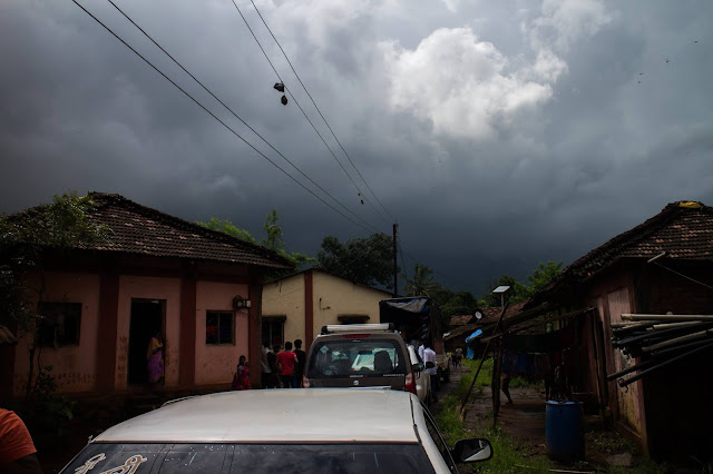
Traveling to the base village Dehri by a local rickshaw transport. The Mumbai suburban railways get you used to hanging and leaning out.
We took the road to the right which led to the Gorakshnath Temple. Our first view of the Gorakhgad and Macchindragad peaks.
The winding path through the jungle were preceded by local fields, and cattle.
So many different varieties of green in the jungle as we trudged through .
Dense vegetation all around us, and this was one of the more well defined paths.
We proceed amidst the jungle in single file as the path winds slowly uphill. The gradient here was not steep at all, and the climb was not strenuous at all .
I clicked someone else doing its own climb amidst the leaves, and like us, it must have been amazed at the jungle cover.
Paths with huge rocks , often provided a place to anchor a hold , in the soil which was slushy due to rain.
A view of the surrounding plains, as captured when we reached the first clearing in the mountains. Notice the variety of the trees.
Onward we climb, as it gets steeper as well as the jungle gets even more dense.
Another view of the plains, from a bit higher and from another side of the mountain as our trek path winds around it..
No, I am not trying to push it. But this is just what lay in our path as we proceeded upwards.
You can tell we have reached the plateau of sorts , much higher than before. It also threatens to rain and the clouds are closing in.
This was almost like a place made for me. The ancient Shiva temple we were about to see must have inspired me, but I apologize for doing this still wearing my trekking shoes.
It is almost as if this barren branch leaned back is surprise on sighting the Gorakhgad peak so close, and said "Aiyyo!"....
The Forest department provides information about the Gorakhgad and Macchindragad at this point. We have come roughly one kilometre up, and will now see ancient Satvahan dynasty ruins , carvings, caves, and must now face rock cut steps in out final approach to the peak.
The ancient Shiva Temple precincts.
More of the same temple.
The padukas still preserved at the temple.
The dense jungle now gives way to grassy land as we approach the peak
This is how tall the grass was. (The tallest among us was sitting there) ...
A clear sky and it inspires this click .
Machhindragad , clicked through a gap as we climb.
We have reached the caves , approaching from the left. The greyish rock in the centre of this photo hides the steps which we climb to enter the caves.
We had come in from the steps on the left . Above us lies the steepest climb to the peak. I still wonder how devotees climbed these places in the old days, and did penance in the caves.
Another view of the caves, highlighting the steep gradient to the peak, and the sheer drop below the caves.
An inside view of the caves, with art work and inscriptions. This place was amazingly free of the typicall graffiti one sees normally. Possibly because hordes of people do not come to visit Gorakhgad.
Some views of what surrounded us as we climbed on.
Steep falls and tough rocks. And when you climb , it is a treasure of history.
We finally make it to the top, climbing carefully through some very old rock cut steps, which don't just go straight but take assorted turns .
Macchindragad , standing close by, in its own majestic glory.
Our trekking group, enjoying a well deserved rest . It was like watching a movie of Mother Nature all around us, but I wouldn't want to be sitting in the front seat....
I make an effort to stand on Gorakhgad , right alongside Macchindragad.
A Shiva temple at the Gorakhgad peak
Yes. We begin the descent, and as always, with all these steps, this is more difficult than the ascent. You can see some other group people being very careful, clutching the rocks for support and slowly descending.
A twenty foot rope has been installed at this point to help trekkers hold on and descend the difficult parts. Some didn't need to use it, but it was helpful.
This is the detachable ladder provided on Gorakhgad. It fixes into knotches in the rock, and you stand on it and climb down. Here is one of our group doing the needful as i prepare to come down. And another member keeps watch from after me.
The descent continues in a careful manner. It had rained and the steps were extremely slippery.
The rain , the clouds, and the camera all conspired . Perhaps the Gorakhgad thought another new Fort had suddenly come up on the left. :-)
I had to capture these grasses just for the color.
Bidding goodbye to the mountains.
And here , bidding goodbye to you....


